Your digital logbook
The Ekynavy Essentials
Everything you need to navigate with peace of mind
Prepare your navigation
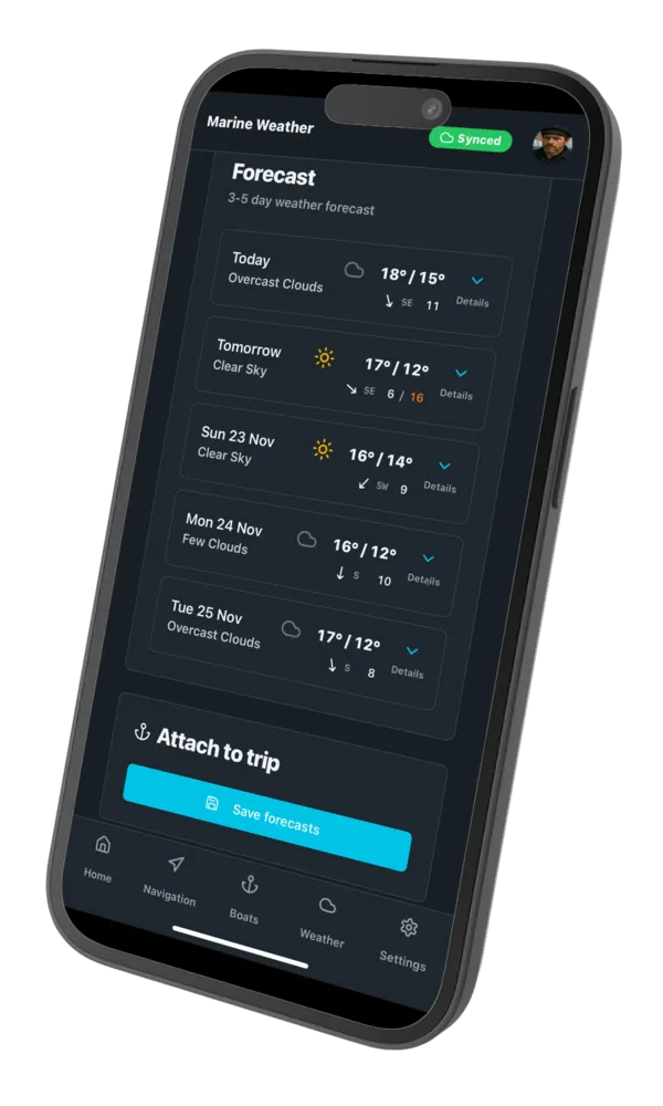
Check, save marine weather and plan your navigation
- ✓3-5 day weather forecast
- ✓Wind, temperature, sea state
- ✓Tides and currents
Navigate and track your navigation
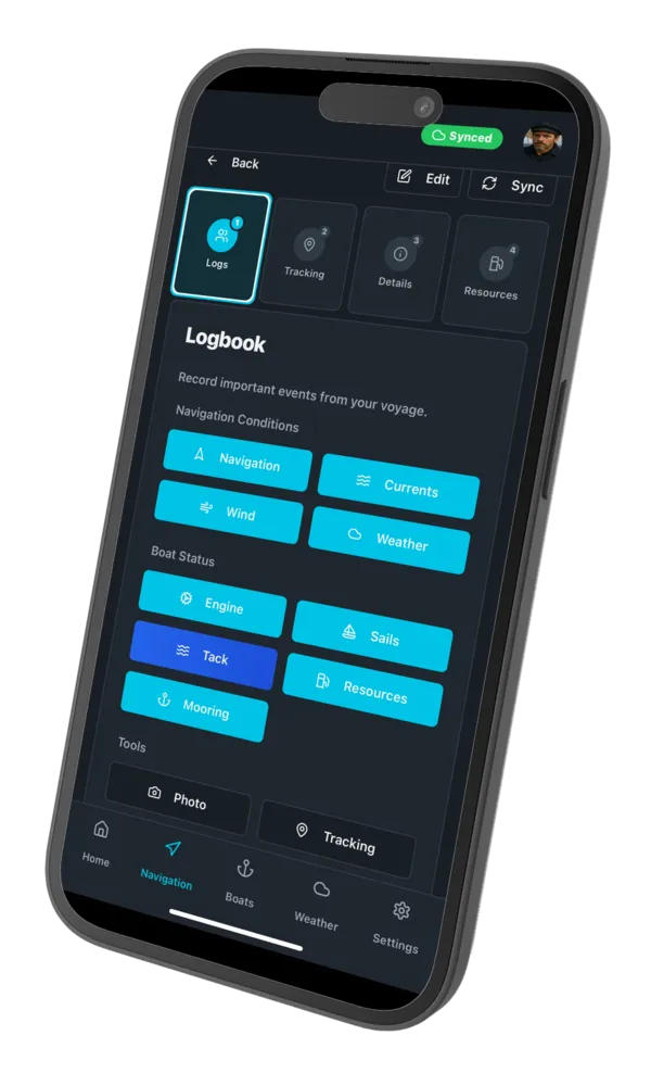
Real-time GPS tracking in online and offline mode
- ✓Automatic GPS tracking
- ✓Interactive map with your route
- ✓Real-time statistics
Relive your adventures
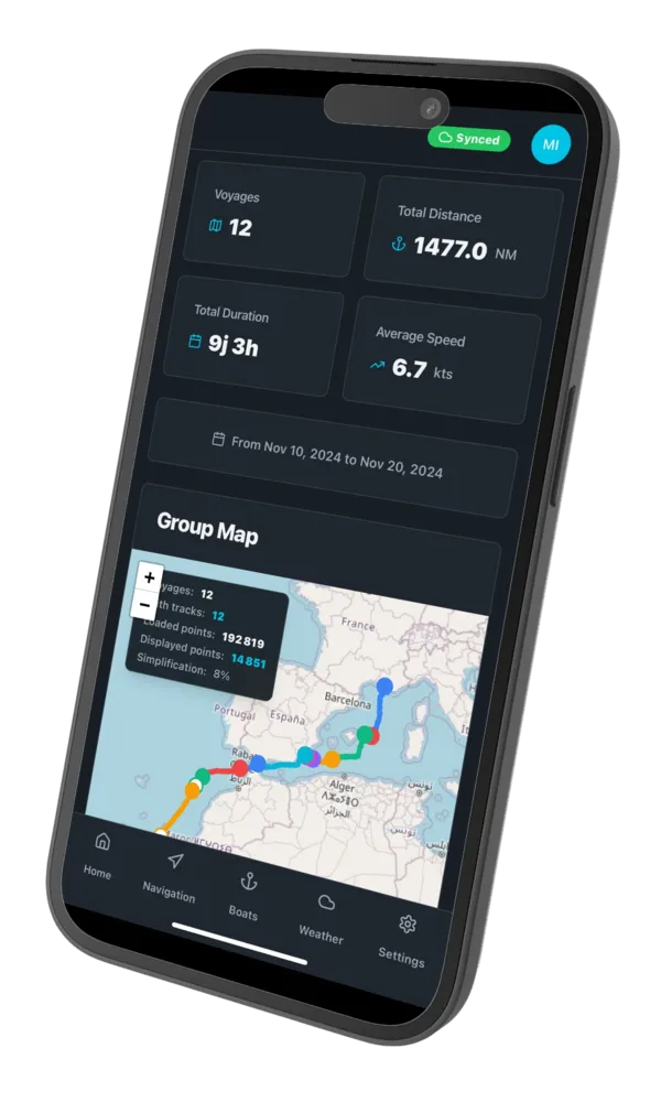
View your detailed logbook and share your trips
- ✓Complete logbook
- ✓Geotagged photos and notes
- ✓PDF export and sharing
Prepare your navigation
Check, save marine weather and plan your navigation
- ✓3-5 day weather forecast
- ✓Wind, temperature, sea state
- ✓Tides and currents
Navigate and track your navigation
Real-time GPS tracking in online and offline mode
- ✓Automatic GPS tracking
- ✓Interactive map with your route
- ✓Real-time statistics
Relive your adventures
View your detailed logbook and share your trips
- ✓Complete logbook
- ✓Geotagged photos and notes
- ✓PDF export and sharing
Add your logs with ease
Record all navigation events: weather conditions, sea states, engine management, sails and resources
Logbook
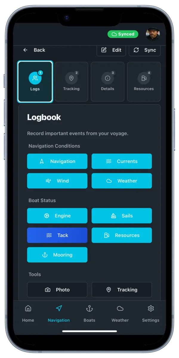
GPS Navigation
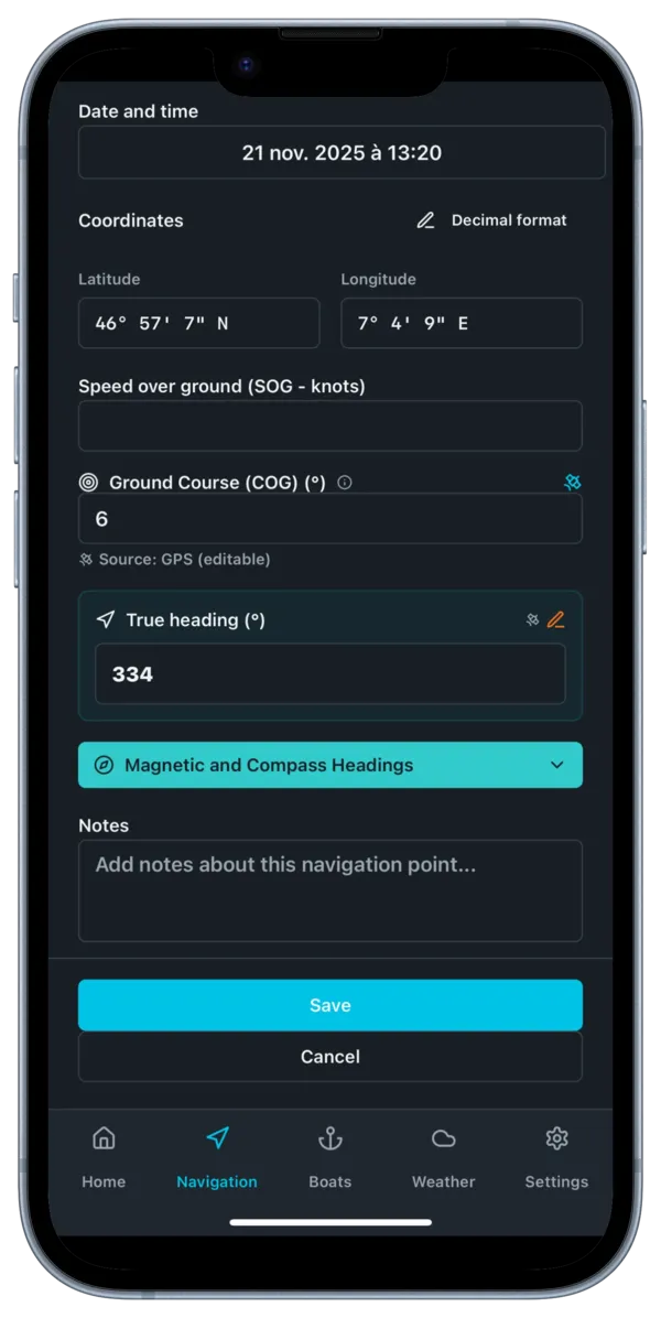
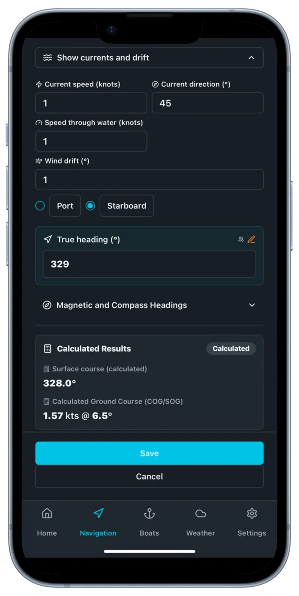
Currents and drift
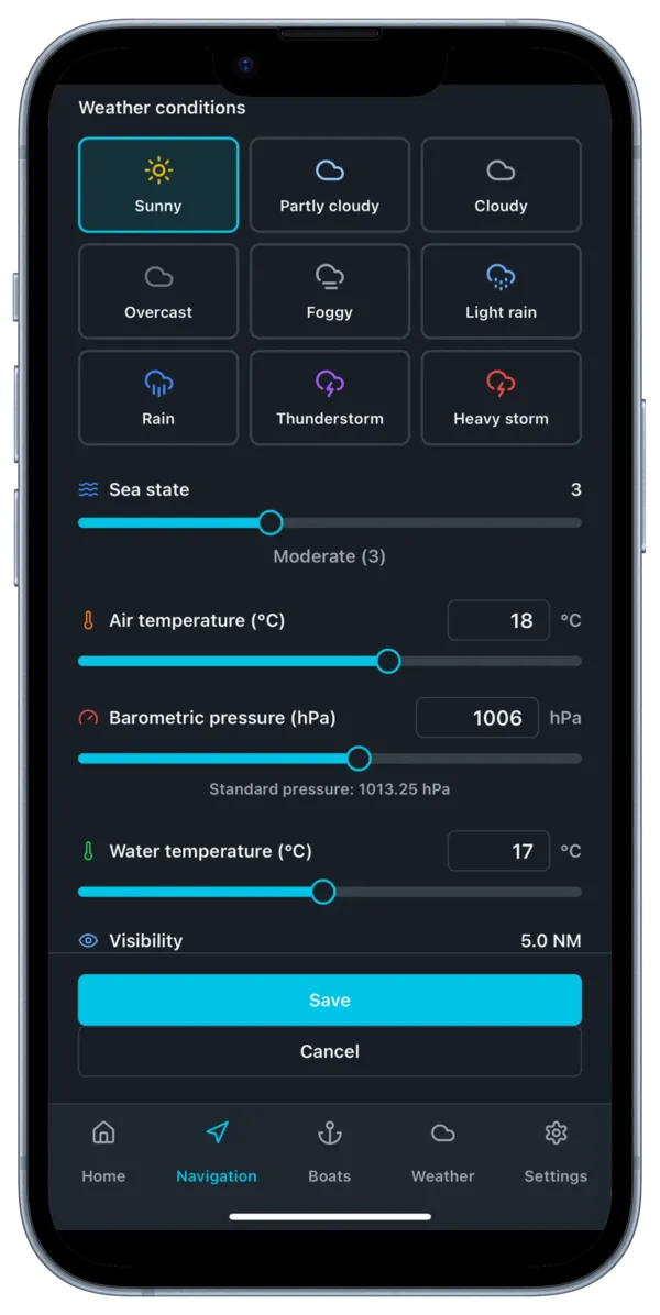
Marine weather
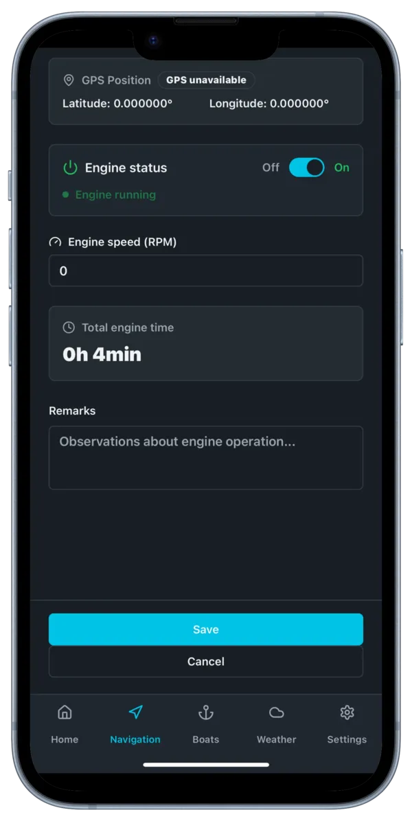
Engine management
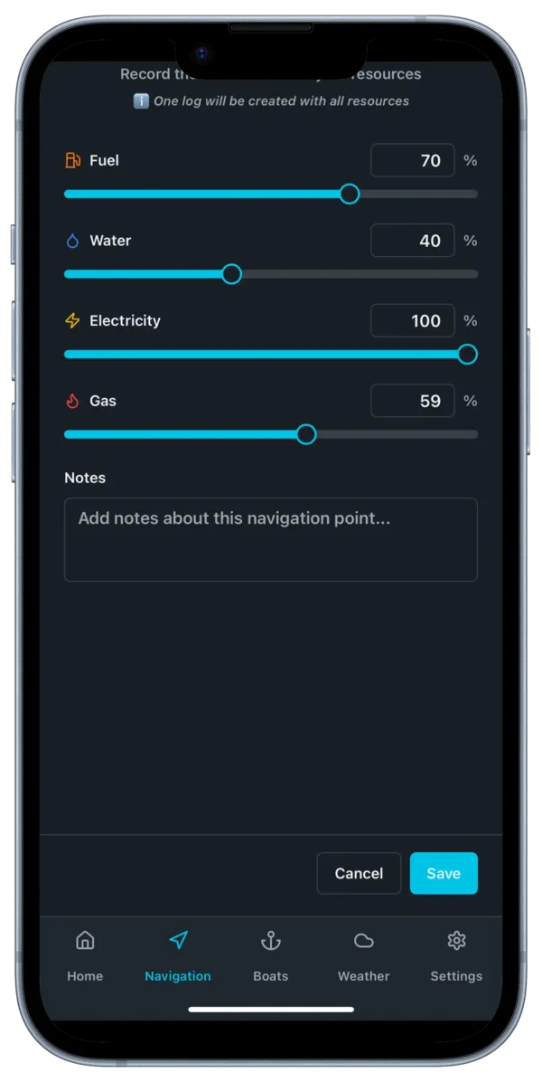
Onboard resources
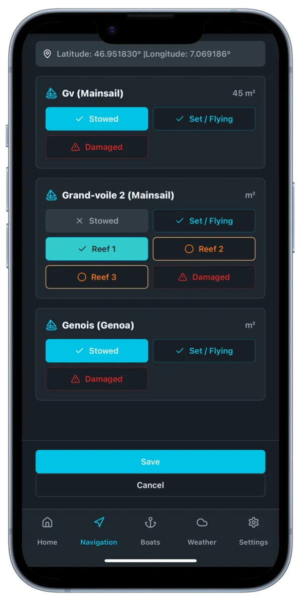
Sail configuration
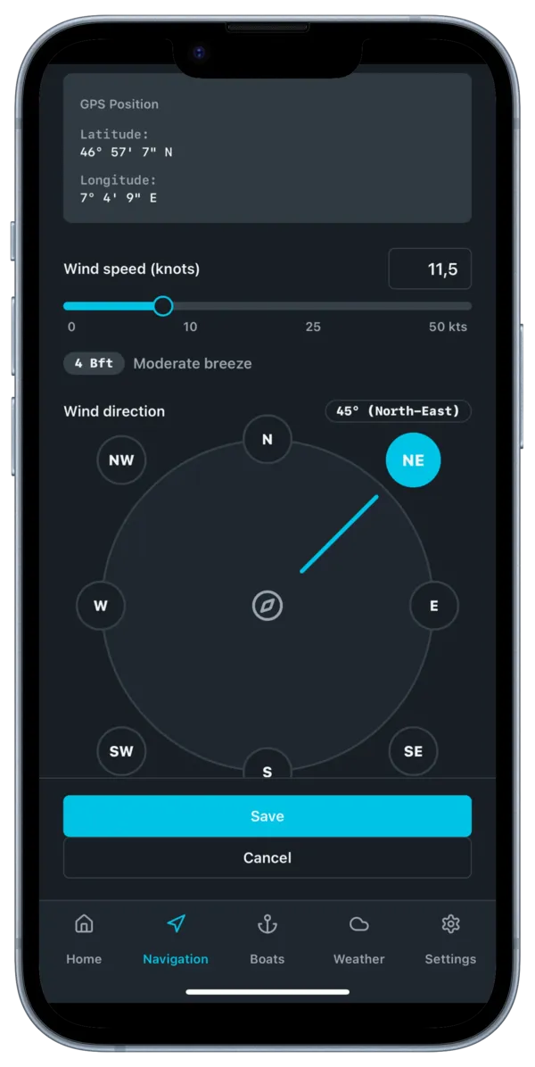
Anemometer and wind
Also on desktop
Plan your trip, check the weather and relive your adventures comfortably at home.
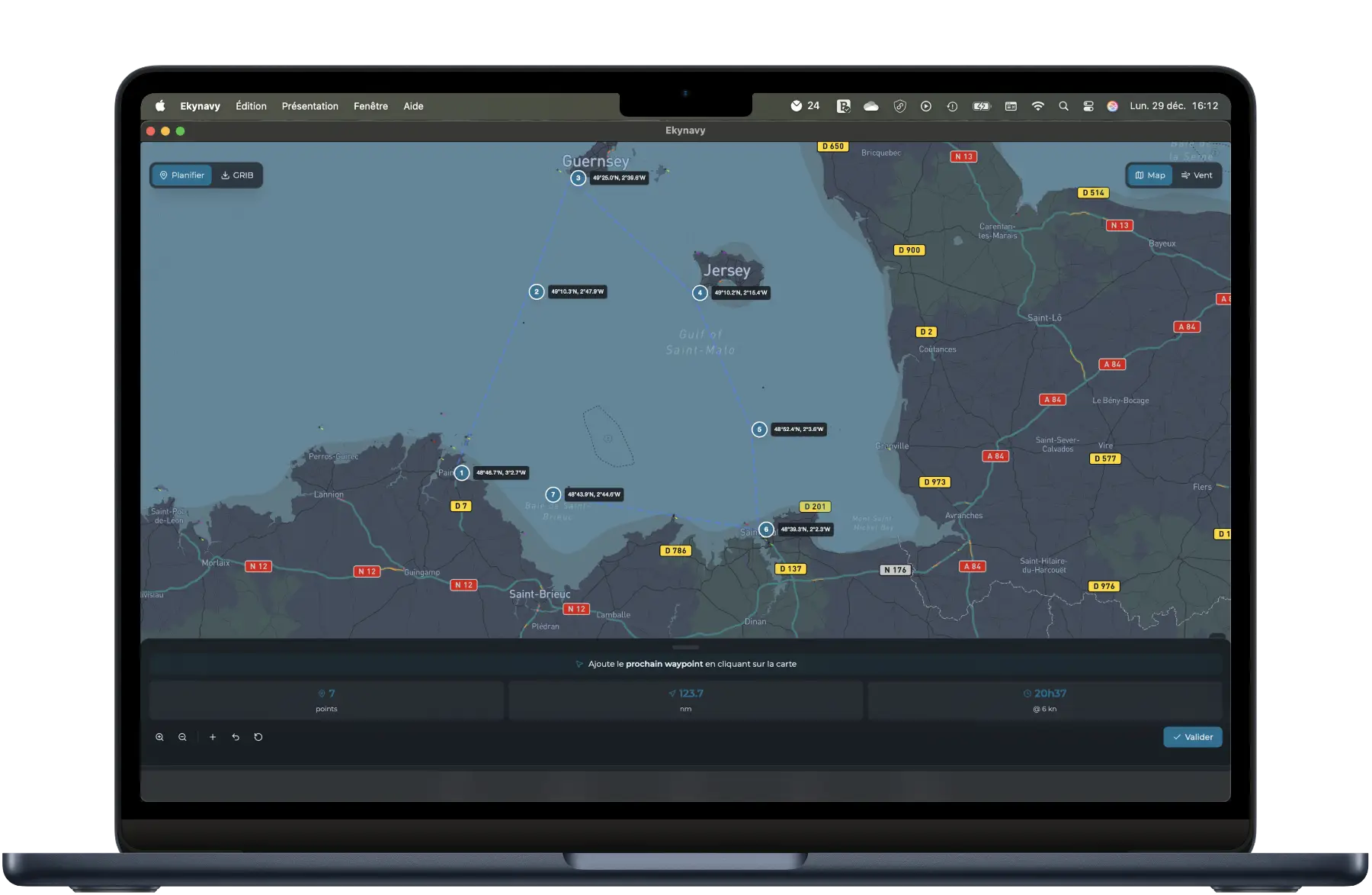
Plan your route
Draw your route, add waypoints and check GRIB weather data directly on the map.
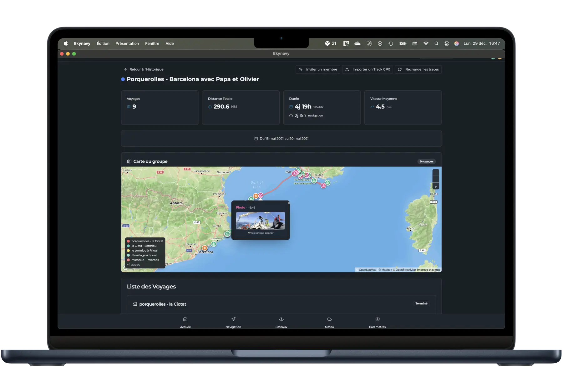
Relive your adventures
Find the complete history of your trips, your geotagged photos and navigation statistics.
Plan your route
Draw your route, add waypoints and check GRIB weather data directly on the map.
Relive your adventures
Find the complete history of your trips, your geotagged photos and navigation statistics.
Ready to set sail?
Replace your traditional maritime logbook with Ekynavy.
Automatically record your GPS tracks, add logs, and review your history with ease.
Share your navigation with your crew: everyone can add their own logs, even without network — everything syncs as soon as connection returns.
Join the Ekynavy community today and embark on a new way to navigate.


How it works
Create your account
Sign up in seconds and access the application
Add your boat
Register your vessel details and crew
Start tracking
Begin automatic GPS recording of your navigation
View your history
Visualize your routes, statistics and export your data
Precision GPS tracking
Precision modes
Features
Real-time statistics
8 specialized log types
Record every detail of your navigation with specialized entries
Navigation
Position, heading, speed
Weather
Conditions, pressure
Wind
Direction, speed
Sails
Configuration, reefs
Engine
Status, hours
Resources
Fuel, water
Anchor
Anchorage, chain
Photos
Geolocated
✅ Timestamped, exportable log
Professional marine weather
GRIB models
GFS, Arpège, Arome - 5-day forecasts
Automatic model selection
Best resolution based on your location - forecasts up to 16 days
Integrated Windy widget
Interactive weather map with animations
Barometric monitoring
Real-time pressure drop alerts
Tides
Heights and times via WorldTides API
Smart route planning
Waypoints
Drag & drop placement and reordering
Auto calculations
Distance, duration, ETA per leg
Dynamic ETA
Adjusted for tidal currents
Weather routing
Forecasts at each waypoint
Offline storage
Weather available offline, auto-update when route modified
Voyage History
Find and analyze all your past navigations
Map visualization
Your tracks on map background
Detailed statistics
Distance, duration, average speed
GPX import
Integrate external tracks
Export & share
PDF, GPX, shareable links
Timeline
Filter by boat and period
Navigation on your wrist
Control your tracking and view stats directly on your Apple Watch
Tracking control
Start, stop, pause from your watch
Real-time stats
Speed, heading, distance, duration
MOB alert
Return guidance to alert position
Integrated nautical charts
Professional nautical layers for precise navigation
Available layers
OpenSeaMap
Beacons, buoys, ports - maritime signage
EMODnet Bathymetry
European seabed depths and relief
SHOM Data
Compatible with French SHOM charts
NOAA Data
NOAA nautical layers for US waters
Features
Offline cache
Download tiles for offline navigation
Multi-source
Combine different layers as needed
Maritime signage
Lighthouses, beacons, restricted areas
Depth contours
Detailed depths and isobaths
Navigate to
Real-time directional guidance to a waypoint or log
Man Overboard Alerts
Vital safety feature synchronized across all devices for immediate response
Real-time sync
All crew members alerted on iPhone, Android and Apple Watch
Guided navigation
Direction arrow and distance to exact position
Multi-modal alerts
Audio alarm, vibrations and high-priority push notifications
Map marker
Red circle at precise GPS coordinates
Anchor watch
Sleep peacefully, your anchor is being watched
Chain assistant
Depth × wind × tide ratio calculation
Adaptive GPS
Battery-friendly, precise on alert
Stop from your wrist
Native Apple Watch
Automatic recovery
Watch resumes if the app restarts
Offline-First Mode
Navigate without connection, sync on return
Local storage
Data saved locally
Auto sync
Synchronization when back online
Smart cache
Boats, voyages, logs in memory
Offline maps
Download navigation areas
Continuous tracking
GPS active even without connection
Sync queue
Actions pending synchronization
Invitation System
Easily invite crew members and observers
Boat invitation
Permanent access to a boat
Trip invitation
Access to a specific voyage
Group invitation
Access to multiple voyages
Secure links
Invitation with expiration
Notifications
Real-time alerts
Easy acceptance
One click to join
Maintenance tracking
Fuel, repairs, inspections - everything is tracked
Events
All maintenance event types
Costs
Multi-currency analysis with payer
Statistics
Charts by period and category
Crew Health Form
Share essential medical information for emergencies
Medical information
Blood type, allergies, treatments
Emergency contacts
People to notify
Insurance
Documents and policy numbers
Passport
Secure document scan
Selective sharing
Choose who sees what per boat
Privacy
Full control of your data
Navigator Profile
Centralize and share your nautical CV
Experience levels
From beginner to expert
Licenses & certifications
Coastal, offshore, captain certificates
Smart scan
OCR to extract information
Shareable CV
Public or private link
Miles accumulated
Total nautical experience
Complete fleet management
Sailboat, motor, catamaran, trimaran
Role-based permissions system
Advanced nautical configuration: compass deviation, sails, engines
Join Ekynavy's evolution
You use Ekynavy and have ideas to improve it? Join the community!
Vote for the features you want to see as a priority or propose your own ideas.
Together, let's build the best digital logbook for navigators.
Frequently asked questions
Latest articles
Practical guides to sail safer, better prepared and better documented.
Configure and Log Your Sails and Engine | Ekynavy
Set up your sails and engines in EkyNavy and log their use during every voyage. Usage statistics included.
3 min read
Sailing Crew Management: Tools and Best Practices | Ekynavy
How to organise your crew on a sailboat: briefing, watches, passenger manifest, app access sharing, safety. The 2026 skipper's guide.
8 min read
GPS Tracking on Sailboats: Accuracy, Battery, Offline Explained | Ekynavy
How GPS tracking works on a sailboat: real accuracy, battery drain, offline mode. The technical guide to understand and choose.
8 min read
User Guide
Share Ekynavy